
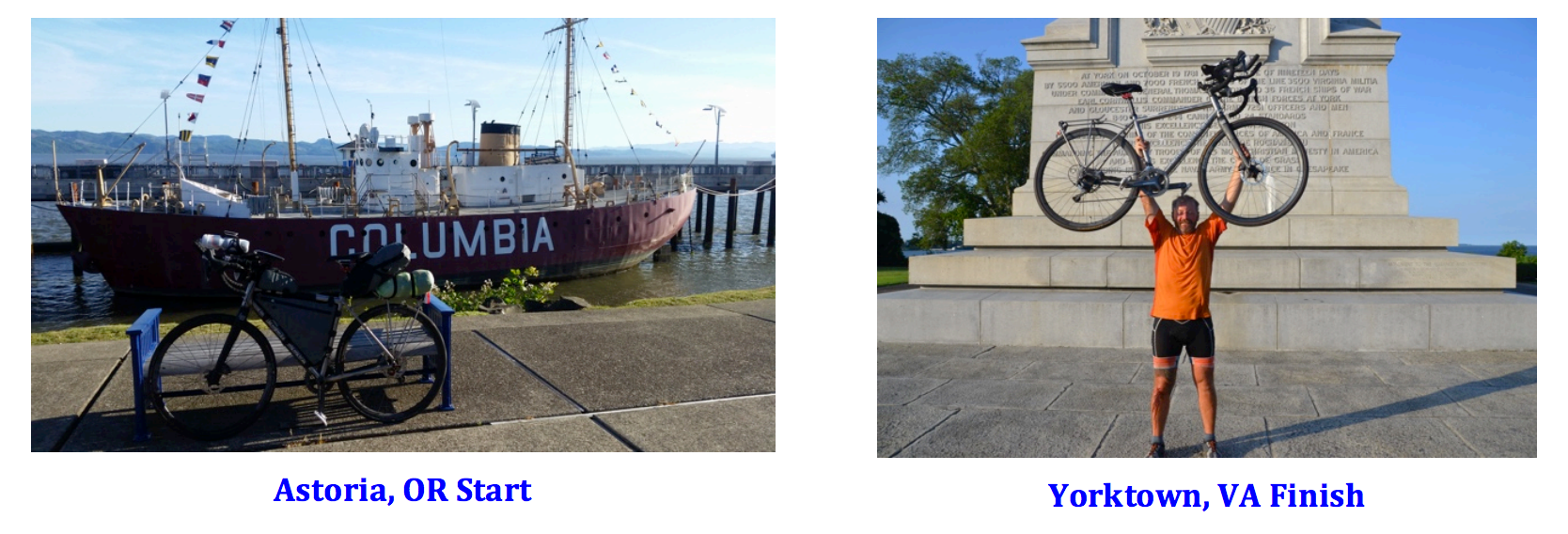
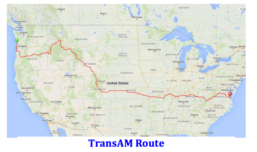
Traversing America via 10 states over ~4200 miles
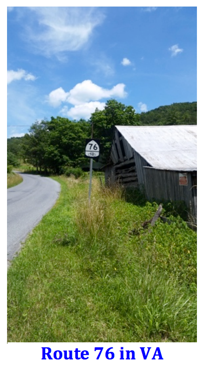
The TransAmerica Bike Race (TABR) uses the US Bicycle Route 76 established as part of Bikecentennial in 1976. It provides variations in terrain, elevation, wind conditions and temperatures that add to the difficulty.
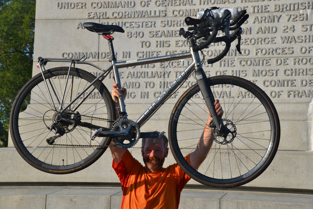
Let me start by thanking the team at Litespeed for their support in helping design an amazing ride. The T5g proved to be very well suited for this venue given the durable titanium frame as well as the geometry providing versatile ride comfort. Outfitted with Ultegra components, areobars and rear rack mounts it held all the necessary gear securely. With an Oveja Negra custom frame bag allowing lots of storage while maintaining a streamline profile. The bike handled everything thrown at it from rough country roads, gravel, steep climbs/descents and two spills. The bike is always the first thing checked after a wreck and it fared better than I did in each case. I’d recommend anyone looking to have a truly versatile bike that can tackle any terrain consider the T5g. Great for touring or just run fast without the extra storage I utilized.
This event is still in its relative infancy while the route celebrates the 40th anniversary. There is no prize money or trophies for the top finishers. Racing only for pride, bragging rights or a sense of personal accomplishment, as was my case. Everyone embarks with different expectations that are realized, reset or unfortunately in some cases abandoned.
Here are some thoughts regarding the adventure. Specifically regarding key considerations, people, places and brief summary of closing thoughts.
Key Considerations
What needs to be taken in to account in order to successfully complete the TABR in less than 40 days:
- Time - At least 3 weeks to complete including the pre/post race travel.
- Travel Expenses - Vary greatly depending on speed & hotel stays vs. camping.
- Endurance - Ability to pedal 10-18+ hours a day.
- Attitude – Remain positive given the variety of challenges faced.
- Bicycle and Gear – A comfortable bike with lean touring storage.
These are the basics to determine if racing is viable. If you choose to race, identify what is essential gear to reduce volume and weight. Be prepared for a physically and mentally challenging endeavor. Train for consecutive 100+ mile days with longer rides of 150-200 miles.
The Adventure Begins
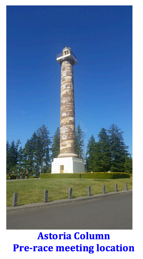
After a flight to Portland and unpacking the bike I began the journey riding to Astoria for the start. Quickly realizing the impact of a bike weighing 45-50 pounds loaded with gear. Keep in mind touring riders carry far more gear weighing in 85+ pounds. My gear list at the bottom for those interested. Having already met a few riders earlier in town we headed up to Astoria Column for a group gathering and to get tracking devices for the June 4th start. It was an opportunity to meet a collection of international racers and see how they had outfitted their bikes. It varied from almost no storage to full touring setups. Steele, titanium and carbon frames outfitted with a wide range of wheels including dynamos for device charging.
The People
Of course you meet fellow racers but along the route you encounter local residents, touring riders and even a few race fans. All the racers I met they were incredibly friendly and supportive. There were 66 riders registered for the race this year. The first week riders quickly spread out leaving me alone for the vast majority of the ride. I was able to ride with a couple others the first few days but eventually would ride alone. Only briefly meeting westbound racers going the opposing direction adding to the isolation of racing. The entire group is an impressive bunch considering the level of commitment required. In the end about 25% scratched from the event due to injuries, equipment issues and time constraints.
I also met touring riders on the route traveling both directions typically with more gear, panniers front and back. While moving slower they had time to appreciate the scenery, towns and people to a greater extent along the way. Most stated they were taking anywhere from 60-90 days to complete the route. Some traveled with support vehicles carrying less gear than racers but moving at a similar pace.
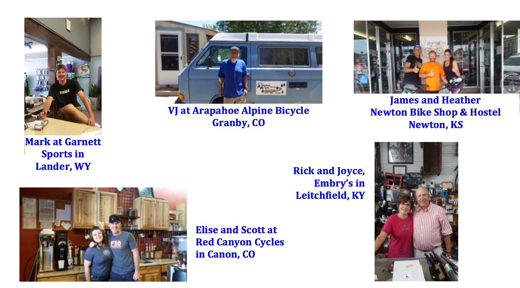
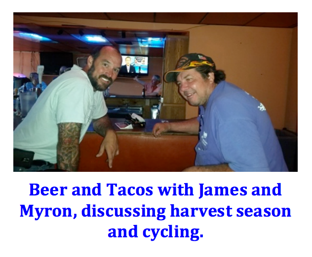
Along the route there are many operators of restaurants, convenience stores and bike shops that are incredibly supportive. Some stayed open late or provided service after hours. This was critical in a few instances for water, food or spare parts resupply where I had not timed my travel to capitalize on their business hours.
The bike shops being the most important given you can travel hundreds of miles without a shop directly on the route itself. These were the shops that played a key role in my success:
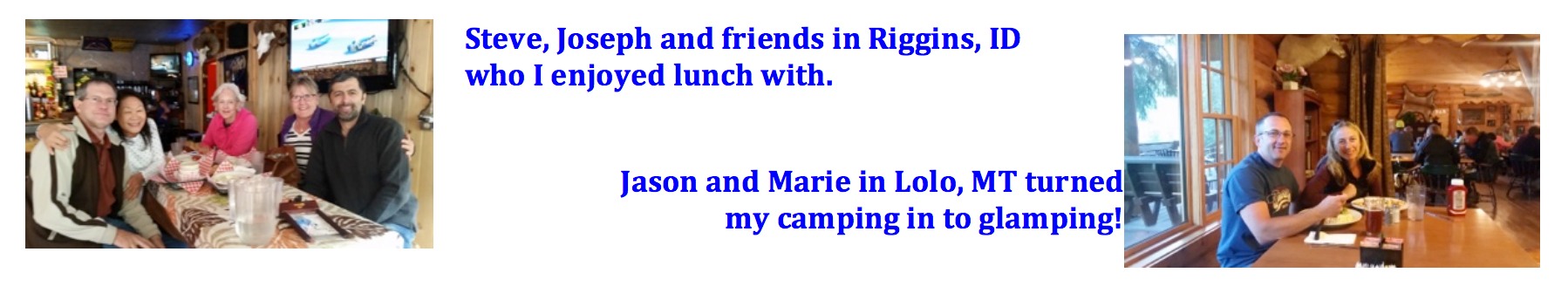
I also ended up connecting with many new friends and supporters along the route. Similar to hiking the Appalachian Trail I found there were many people that wanted to offer unconditional support. Anything from offering rides to get repairs, clarifying directions, providing a drink, buying lunch/dinner, offering a place to stay and in a few instances riding along for a few miles in support. All good as long as you abide by the rules of the race. Here are a few of the many:
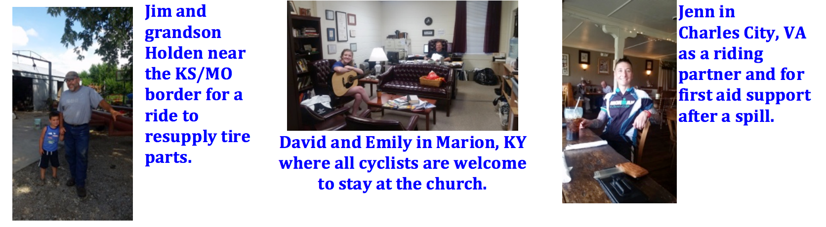
Last but not least along the route are the dot watchers. Supporters of the race that track us and go out of the way to meet us when we come through their towns providing a huge morale boost:
Mike - Ash Grove, MO - Greets racers with a cold beverage, food and runs a hostel
Wayne - Farmington, MO- Rides with most racers near town and likely to grab a beer with you if you stay the eve
Paul - Berea, KY- Greets racers with drinks, food and local advice
I was lucky having had the opportunity to meet so many wonderful people along the way. While they admired efforts of racers we frequently agreed you have to be a little bit crazy to tackle such a challenge. The interactions with everyone made the trip far easier and more fulfilling. Whether you tour or race this route or other adventure cycling routes get to know the people.
The Places
The route is predominantly lined with small towns. Many don’t have any services that force you to plan ahead relative to supplies. Learning to utilize the maps in conjunction with a smartphone to confirm services ahead is very important. Tips from other racers also help.
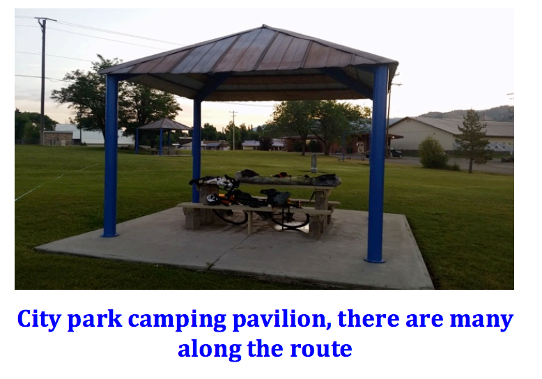
Many towns have parks with picnic areas that you can camp in as an example, some with showers. I had heard about camping behind the guardrails on remote roads, the use of US Post Offices to avoid storms and other nifty tricks. There are also hostels and churches along the route that you can stay at for a nominal fee, donation or in some cases for free. In the end I stayed in a hotel about half of the nights and camped out or used hostels/churches the remainder.
Food was most often secured in convenience stores. Places with a diner, café or restaurant are welcome sights providing you can afford the time. The best conversations took place at the restaurants meeting the locals. The food is far better when compared to that of a quick stop shops. Providing an opportunity to recharge devices while resting out of the elements.
All along the route there are spectacular sights of natural beauty and many points of historical significance. Racing does not afford the opportunity to fully appreciate either. As I passed some such as the burial place of Sacajawea, the Lincoln Homestead and numerous battlefields I realized the benefit for those not racing. That being said, I had a revised goal to complete the route in less than 40 days without taking a day off.
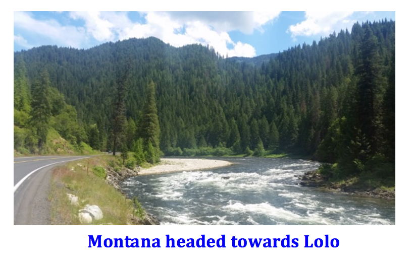
While my decision did not afford me the opportunity to stop at historical locations I did take in the natural beauty of the Oregon coastline, the seemingly endless scenic rivers in Idaho and Montana as well as the grandeur of Yellowstone and the Tetons.
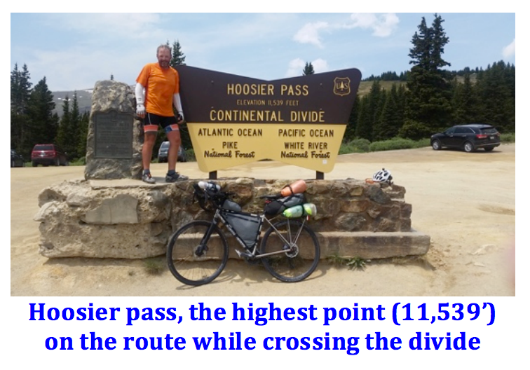
Crossing Hoosier Pass near Breckinridge felt like a significant milestone. I didn’t realize the task ahead within the Missouri Ozarks, frequent short steeply rolling hills that had me feeling like I was doing interval training. Carrying speed from hill to hill with a fast descent could conquer some of the hills. Others were hike-a-bike moments the locals called out as the “BIG Ones” that most cyclists walked up. Many say the western states have a more gradual incline making them easier. I felt that was true, perhaps influenced by the cumulative effect of racing for many weeks. The Missouri drivers were very considerate, the best of any state relative to sharing the road and doing so to ensure safety
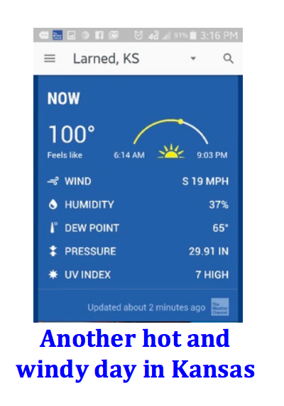
Kansas was one of my most difficult stretches. There were scenic areas when approaching nearby farms, barns and small towns. The relatively flat roads that drifted seemingly to infinity in large fields proved challenging. Compounded by harvest season activities with large farm equipment being transported on the roads. When they pass there is little room for a car to pass from the opposite direction much less a bike simultaneously. Coupled with the heat and winds I found myself being tested to a greater extent. When you are in the saddle for an average of 10+ hours a day there are always a few hours of feeling rough, regardless of location. Thankfully the people were so nice to help overcome the daily grind.
Kentucky is known for unleashed dogs and hills. It was funny that when I asked, everyone reinforced the dog problem, riders and locals alike. People in Western Kentucky referred to it as an Eastern Kentucky issue. As I moved eastward everyone kept saying that’s further east. There was an increase as I moved east relative to dogs chasing me or showing aggression but thankfully I never had an incident. The hills were steep with some sharp turns and narrow roads. I found myself wrecking on a section with a very sharp unexpected turn that a resident called suicide hill. Thankfully I was able to continue with some minor road rash.
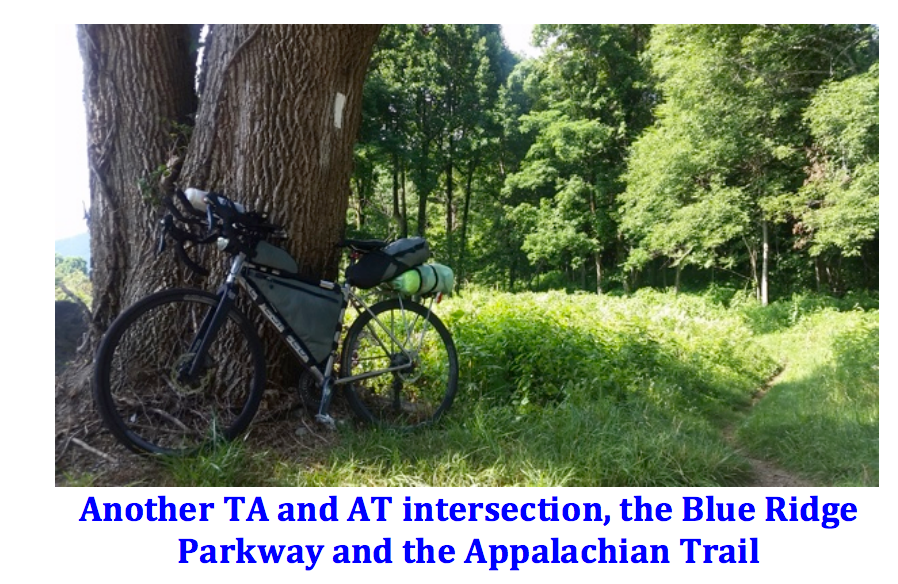
The final stretch felt like home. Having hiked the AT in 2015, places like Damascus and Daleville were very familiar and provided a level of comfort. Being close to the end, knowledge of the area and not expecting any surprises helped. With the final climb over the Blue Ridge Parkway presenting the last big one before a smooth roll out to the finish. What I appreciated was seeing the terrain from a different perspective. Instead of hiking over ridges I was traveling some adjoining terrain via the roads in the valleys with the occasional intersection to bring back memories of last year’s endeavor.
In the end every state provided unique challenges and sights to be appreciated.
Closing Thoughts
In hindsight I would have only changed a few bike/kit items. The tarp was unnecessary, a bivy sack and sleeping bag are sufficient since there are other options for overhead cover. A sleeping bag is recommended since it can get below freezing at elevation. I also would have started with tubes and a better tire like the ones I finished with, Gatorskins. The initial tires were not as durable for the occasional road conditions and debris. Aside from that, the bike setup was perfect.
Special thanks to Mark Wensell for being there at the finish and taking some memorable photos. Having him join us was an unexpected pleasant surprise.
I would be remiss to not thank my sister for her continued support. She provided air cover for daily needs at home and ensured my daughter joined us at the finish as in the past. Without the support of my family, friends and even the feedback from Facebook posts the journey would be far more challenging. The comments always provide motivation when I check in.
This route is great for those seeking an adventurous journey with a desire to explore, just take it slow and enjoy all it has to offer. For those seeking a challenge to test their limits, racing is the way to go.
Final Bike and Gear List
- Litespeed T5g size M
- Ultegra Components
- Cranks 46/36 170mm crank arm
- Cassette 11-32
- VP-R62 Clipless Pedal
- 3T AERONOVA PRO basebar
- Profile Design T3+ Aerobars
- SON 28 Dyna Hub
- Velocity Aileron Wheels
- Continental Gatorskin 700x28 tires
- XLAB TORPEDO KOMPACT
- Oveja Negra Frame Packs
- Platypus Platy Water Bottle - 70 fl. oz.
- Therm-a-Rest NeoAir XLite Sleeping Pad
- Zpacks Bivy
- Hyperlite Tarp (Again I wouldn’t take this again on this route)
- Nemo Down Ultralight Quilt (Once you reach the east you can ship home)
- Cuben stuff sack
- Two spare tubes
- Two Air Cyclinders
- Small multitool
- Small handheld tire pump
- Assos HL.STURMNUSS rain pants
- Proviz Reflect360 Jacket
- First Aid kit with toothbrush
- Assos Chamois Creme
- Spare T-shirt, running shorts and socks
- Full set of TransAm Maps
- Garmin 520
- Ipod nano
- Bluetooth speaker
- Phone
- SPOT satellite tracker
Race and Route Reference Sites
TABR – http://transambikerace.com
US Route 76 - https://en.wikipedia.org/wiki/U.S._Bicycle_Route_76
ACA - https://www.adventurecycling.org/routes-and-maps/adventure-cycling-route-network/transamerica-trail/
Bikecentennial - https://en.wikipedia.org/wiki/Bikecentennial